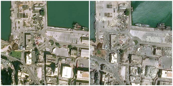
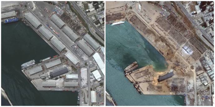
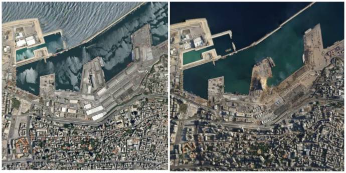
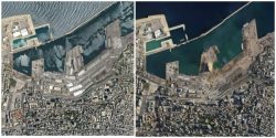
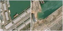
Satellite Imagery Shows Shocking Destruction Of Beirut Blast
Shocking satellite imagery shows the extent of damage caused by the Beirut port blast which decimated many quarters in the capital.
Photograph: Cnes 2020, Distribution Airbus DS
With entire neighborhoods miles away from the blast site lying in ruins, the extent of the damage caused by this explosion is still being uncovered.
Beyond heartbroken, we leave these photos here in the hopes that they will mobilize our readers to shun their political affiliations because every single official is responsible for this catastrophe. They either knew and did nothing, or didn’t do their job well enough to know of the 2,750 tonnes of explosives in our ports.
Photograph: Cnes 2020, Distribution Airbus DS
Photograph: Maxar Technologies/AP
Photograph: Planet Labs
Our thoughts are with all those who have lost a loved one, or are waiting for a missing person. This is surreal.